Overview
The Credit River originates in the headwaters of the Niagara Escarpment near Orangeville and Caledon, and empties into Lake Ontario in Mississauga. The Credit River is approximately 90 kilometres long with a watershed that encompasses 1,000 square kilometres.
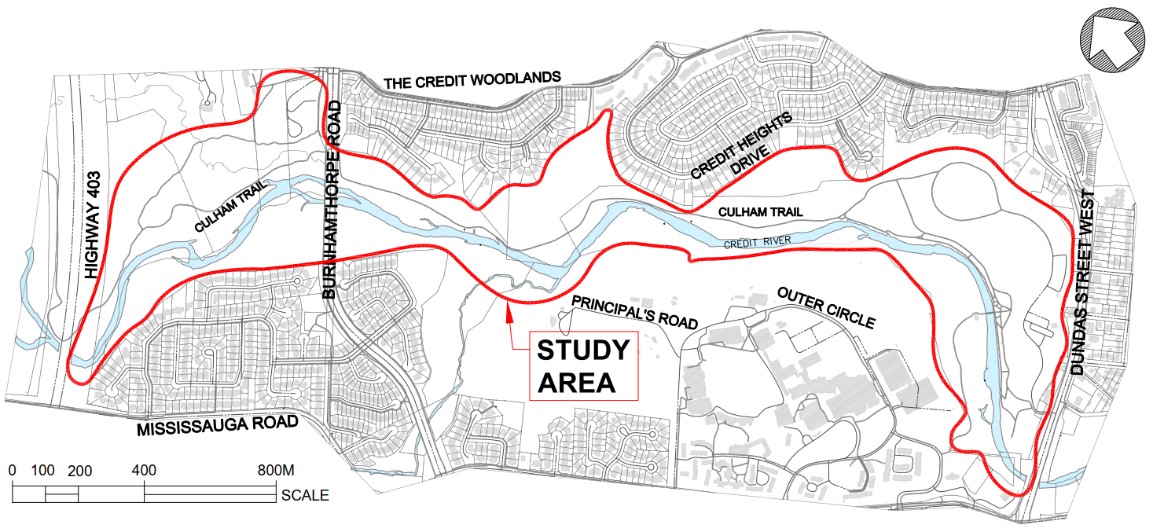
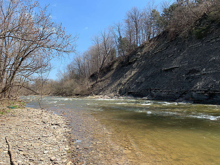
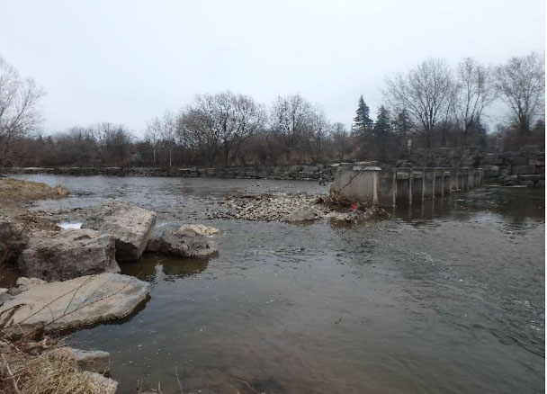
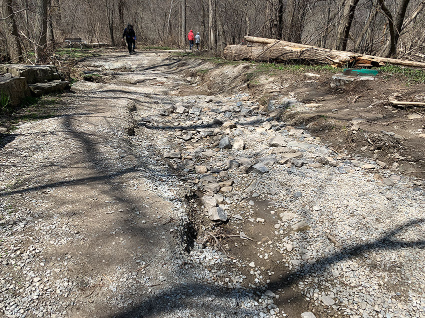
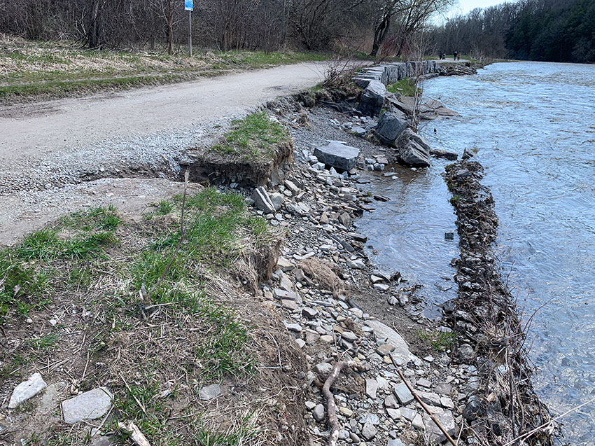
The study area consists primarily of a natural river with segments providing protection for the adjacent Culham Trail by means of armourstone banks, rock vane features and gabion baskets. These erosion protection measures were originally constructed approximately 20 to 30 years ago with repairs completed over the years for certain areas.
This section of the Credit River and Culham Trail are in need of rehabilitation to remediate existing river erosion, risk to property and infrastructure and improve safety. Some of the impacts include segments of failed river bank protection, washouts and damage to the trail, valley wall erosion and ice control.
Objectives
The main goal of this project is to develop a restoration design for the Credit River which mitigates existing erosion problems and provides long-term stability to the river corridor.
Benefits
- Provides long-term erosion protection along the river banks
- Opportunities to enhance trail infrastructure while mitigating flooding and wash outs
- Improvements to ice control and storage
- Increases safety and protects nearby infrastructure and property
- Improves the environmental health of the river while enhancing aquatic habitat and vegetation
- Opportunities for planting of native species, and enhanced wildlife habitat where feasible
Online Public Information Centre
An online Public Information Centre (PIC) was held for the project in early summer 2023. The project team presented the alternative solutions and the preliminary recommended solution identified for the study area to the public for review. The presentation is available in the project documents.
Project File Report
A Project File Report was prepared to document the planning, decision-making and consultation process for this study. The final report and appendices were completed in October 2024. We appreciate all of the consultation and feedback that was received for the report and throughout the study.
Project updates
Construction is estimated to begin Fall 2025.
Project documents
Project File Report
- Project File Report
- Appendix A: Detailed HEC-RAS Results
- Appendix B: Stage 1 Archaeological Assessment
- Appendix C: Cultural Heritage Report
- Appendix D: Concept Design Drawings Sites 1 to 3
- Appendix D: Concept Design Drawings Sites 4 to 6
- Appendix D: Concept Design Drawings Sites 7 to 8
- Appendix E: Evaluation of Alternatives
- Appendix F: Public Consultation