About this project

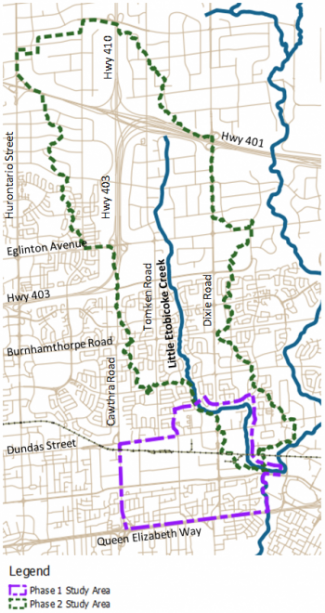
Little Etobicoke Creek, located in the eastern portion of Mississauga, is a small tributary of Etobicoke Creek which flows to Lake Ontario.
The study was led as a Master Plan under the Municipal Class Environmental Assessment (“EA”) process and consists of two phases.
Phase 1 expands on previous studies to identify the extents of flooding as a result of spilling from the Little Etobicoke Creek during high flow conditions.
Phase 2 aims to identify the overland urban flooding risk and identify, assess, and recommend measures to mitigate flood risk to people, property and infrastructure.
Two Public Information Centres (PICs) were held to present information related to the study and answer any questions. Please find the presentations for the PICs available below.
Project File
- Report Cover Page
- Summary Report
- Progress Report 1
- Progress Report 1A
- Progress Report 2
- Progress Report 3 and 4
- Progress Report 5 and 6
- Progress Report 7
Project File Appendices